Beidou satellite after 4 years providing global services can make up for the lack of GPS | Beidou satellite | _ news
 File photo: compass global navigation satellite system planning models. Liang Xu Xinhua photo
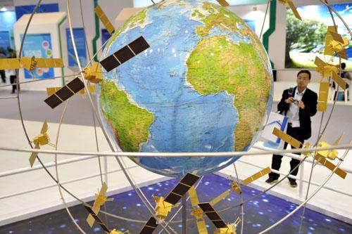
Original title: foreign media: Beidou satellite after 4 years providing global services can make up for the lack of GPS
China's Beidou satellite navigation system on 26th revealed that four years after the satellite will be able to provide more accurate positioning for global services.
According to Singapore the Straits Times website reported on September 26, Xu Ying Beidou satellite research team members said in a interview with TVB in Hong Kong on that day, although the satellite positioning technology is very mature, but there are certain limitations, Beidou satellite complements other system problems.
Xu Ying said, "each satellite navigation systems are limited in number, for example for GPS, and you now say, to a downstairs side, slightly a bit obscured, blocked after from the GPS satellites, you may find that your position (s) worse. In such a case, you can use other satellites in the satellite navigation system and to carry out a joint position. ”
Beidou satellite has now fired 23 2012 scope of services covered by the end of the Asia-Pacific region, will launch more satellites in the future to expand coverage.
Xu Ying said the Beidou satellite navigation system will provide global services in 2020, the next step is to find ways to let the general public can also be used in everyday life to the Beidou system.
She said: "watches, shoes are for children, and school for children, and children's school bus, compass chip is such a loaded Word, then you can know at any time where the child was. ”
Xu Ying also said: "If you find old people get lost, you're such a request may be made to the monitoring center, the monitoring center can give you a feedback positioning information, you will know just where to find the old man. ”
It is understood that the 2008 Wenchuan earthquake, rescue teams through foreign issued the first Beidou satellite information.
In addition, in recent years, China has also used the Beidou satellite tracking animal migration of Tibetan antelopes path.
But she said that the General phone can be done at any time to, first of all to mobile phone manufacturers mobile phone put the big chip, which will be the future direction of promotion.
Source: references
Responsible editor: Kang Yunkai
Article keywords:The Beidou satellite
I want feedback
Save a Web page
China NET
北斗卫星4年后提供全球服务 可弥补GPS不足|
北斗卫星|卫星_新闻资讯
资料图片:北斗全球卫星导航系统规划模型。新华社记者 梁旭摄 原标题:外媒:北斗卫星4年后提供全球服务 可弥补GPS不足
中国北斗卫星导航系统的研发人员26日透露,该卫星四年后就能为全球提供更精准的定位服务。
据新加坡《联合早报》网站9月26日报道,北斗卫星研究团队成员徐颖当日接受香港无线电视台访问时说,虽然目前卫星定位技术已十分成熟,但仍有一定限制,北斗卫星可补其他系统的不足。
徐颖说:“每个导航系统的卫星数量是有限的,比如说对于GPS来讲,你现在比如说到一个楼下边,稍为有一点遮挡,遮挡了来自GPS的卫星之后,你可能发现你的定位精(准)度变差了。在这样一个情况下,你完全可以用其他的卫星导航系统当中的卫星,然后来进行一个联合定位。”
北斗卫星目前已发射了23个,2012年底服务范围已涵盖亚太地区,未来会发射更多卫星,扩大覆盖范围。
徐颖说,北斗卫星导航系统最快会在2020年提供全球服务,下一步工作是研究如何让普罗大众在日常生活中也能用到北斗系统。
她说:“给儿童的手表、鞋都有,还有对儿童的校卡,还有儿童的校车,都进行这样的一个加载北斗芯片的话,然后你就可随时知道孩子在哪里了。”
徐颖也说:“如果你发现老人走丢了,你就可给监控中心提出这样一个请求,监控中心就能给你回馈一个定位信息,你就能知道能去什么地方找到老人。”
据了解,2008年四川汶川发生地震,救援队就是透过北斗卫星对外发出第一条信息。
另外,中国近年也利用北斗卫星追踪保护动物藏羚羊的迁徙路径。
但她说,要做到一般手机都能随时用到,首先要手机生产商在手机加装北斗芯片,这将是未来推广的方向。
来源:参考消息
责任编辑:康云凯
文章关键词: 北斗卫星 卫星
我要反馈
保存网页
中国网