China built the fifth station at the South Pole (photo)
Information on Antarctica.
In the new social Harbin August 15 electric (reporter Shi Yifu) "in Antarctic new section test station, focus Science study regional and has has station District, using Beidou satellite navigation positioning system continuous run benchmark station and series scale measuring figure", 15th, Heilongjiang mapping geographic information Council foreign released, in national mapping geographic information Council Organization held 2017-2019 spending planning storage project review will Shang, by the Council declared of 2017-2019 polar focus regional mapping project through project review.
Future development of the Antarctic continent, has for concern around the world. Currently, four Chinese Antarctic scientific expedition station, respectively, are the great wall station and Zhongshan station, two perennial scientific station and Kunlun station, Tai Shan two summer science research station.
Heilongjiang surveying and mapping geographic information Council has sent 39 people carried out 13 Antarctic scientific expedition missions, research areas cover all of China's Antarctic research station and primary research site, during the expedition team completed a lot of basic surveying and mapping and polar science of surveying and mapping work.
The Heilongjiang surveying and mapping geographic information Council's project, the experts agreed that the project complies with the basic surveying and mapping national medium-and long-term planning and national polar expedition "Thirteen-Five" overall objective, project based on the full, this project will protect the interests of Chinese national polar, overall improvement in surveying and mapping geographic information in support of polar expedition.
Projects around the Antarctic scientific expedition and safeguard China's national interests on the surveying and mapping geographic information needs, established a new station, Antarctica, focusing on scientific expeditions and Beidou satellite navigation and positioning system of the station have been continuously operating reference stations, as well as series scale mapping and other projects.
Group of experts unanimously agreed that "polar area mapping" project implementation projects through, the construction of the new station a step closer.
Author: Shi Yifu
(Editors: xiaowugang UN845)
2016-08-15 16:01:40
China News Network
中国将在南极建第五个科考站(图)
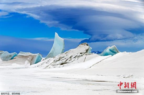
资料图 南极洲。
中新社哈尔滨8月15日电 (记者 史轶夫)“在南极新建科考站,重点科学考察区域和已有站区,运用
北斗卫星导航定位系统连续运行基准站以及系列比例尺测图”,15日,黑龙江测绘地理信息局对外发布,在国家测绘地理信息局组织召开2017—2019年支出规划入库项目评审会上,由该局申报的2017—2019年《极地重点区域测绘》项目通过立项评审。
南极大陆未来的开发利用,已经为世界各国关注。目前,中国有南极科考站四个,分别是长城站、中山站两个常年科学考察站和昆仑站、泰山站两个度夏科学考察站。
黑龙江测绘地理信息局已先后派出39人次执行了13次南极科学考察任务,科考区域涵盖了中国在南极的所有科考站和预选科考站点,科考期间科考队员完成大量的基础测绘和极地测绘科学研究工作。
此次黑龙江测绘地理信息局提出的项目,与会专家一致认为项目符合《全国基础测绘中长期规划》和国家极地科学考察“十三五”总体目标,立项依据充分,该项目的实施将保障中国国家极地利益,全面提升测绘地理信息对极地科学考察的保障能力。
项目围绕南极科学考察和维护中国国家权益对测绘地理信息的需求,确立了南极新建站、重点科学考察区域和已有站区的
北斗卫星导航定位系统连续运行基准站,以及系列比例尺测图等工程内容。
专家组一致同意“极地重点区域测绘”项目立项实施,项目的通过,对新科考站的建设工作更进了一步。
作者:史轶夫
(责任编辑:肖武岗 UN845)
2016-08-15 16:01:40
中国新闻网